
Enhancing Sustainable Road Infrastructure through GIS-Based Hydrological Modelling: A Solution for Equitable Development and Climate Resilience of Cross Culverts on The Sakpeigu-Chereponi Road (7+100 - 7+750) (N14) At the Yendi Municipality in Ghana
Keywords:
Sustainable Infrastructure, GIS-Based Hydrological Modelling, Culvert sizing, Climate Resilience, Drainage Design.Abstract
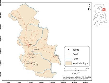
Road drainage is vital for the safety and longevity of transportation infrastructure. Designing effective drainage facilities, including culverts, requires a precise understanding of discharge-frequency relationships. Culverts, which allow water to flow beneath roads, must consider various engineering and environmental factors. In Ghana, the Ghana Highway Authority expects culvert designs to meet peak flow specifications, but evaluating the design flood of each culvert is time-consuming. Typically, drainage culvert designs rely on estimations, which can lead to inappropriate sizes. This study aimed to assess the adequacy of existing cross culverts and propose suitable sizes for inefficient ones on the Sakpeigu-Chereponi road (7+700-7+750) in the Yendi municipality. The study employed integrated GIS and hydrological models to delineate and estimate peak flow using the modified rational method. The catchment for the scheduled culverts was delineated, with a peak flow of 44.552 m3/s for a 25-year design period. However, the combined capacity (32.066 m3/s) of the scheduled culvert sizes was insufficient, resulting in an excess discharge of 12.486 m3/s. A new culvert schedule was proposed, featuring a 3m X 3m box culvert with a capacity of 70.148 m3/s for the entire section (7+100 - 7+750) to address the inadequacy.
Downloads
Published
How to Cite
Issue
Section
Copyright (c) 2023 Abdul Basir Issah, Edward Matthew Osei Jnr, Jeff Dacosta Osei

This work is licensed under a Creative Commons Attribution 4.0 International License.

